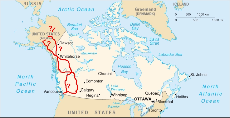
Follow my trip around Western Canada (and Alaska)
|
Follow my trip around Western Canada and Alaska either by scrolling down this page,
or by pressing the ? on the map below. Please
note that by pressing the ? in the British Columbia
area a new map from this particular province will guide you further.
You can also just enjoy the pictures in my album.
These pictures are chosen out from a gallery of over 1000 pictures but
I hope it will give you an idea of the beautiful and unspoiled nature "over there".
|
|
|
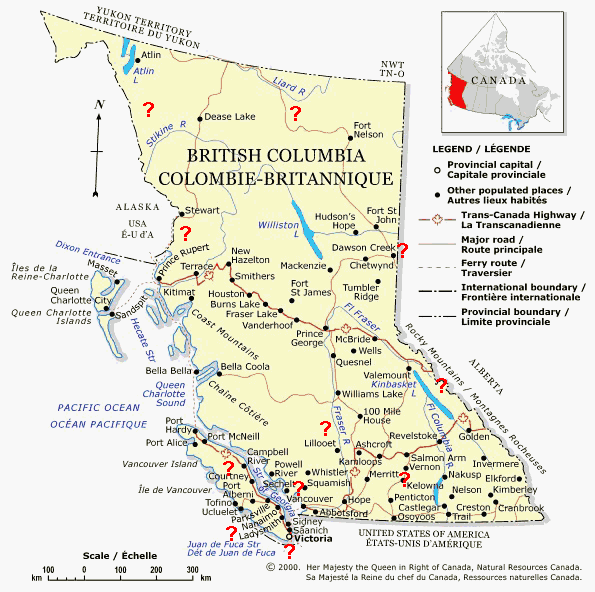
Detailed map of British Columbia
|
Vancouver
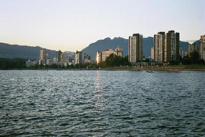
Sunset over Vancouver |
Sunset over Vancouver seen from Kitsilano Beach BACK TO BRITISH COLUMBIA MAPBACK TO CANADA MAP |
|
Downtown Vancouver is beautiful and green. BACK TO BRITISH COLUMBIA MAPBACK TO CANADA MAP |
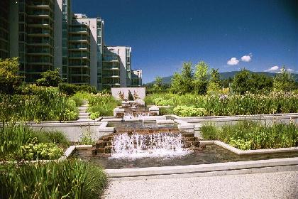
Downtown Vancouver near Coal Harbour |
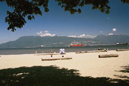
Jerico Beach and English Bay |
There is a lots of nice beaches along the English Bay. BACK TO BRITISH COLUMBIA MAPBACK TO CANADA MAP |
Victoria / Vancouver Island
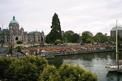
Downtown Victoria |
Downtown Victoria is very beautiful. BACK TO BRITISH COLUMBIA MAPBACK TO CANADA MAP |
|
Sooke can be found a few kilometre from Victoria along the coast. BACK TO BRITISH COLUMBIA MAPBACK TO CANADA MAP |
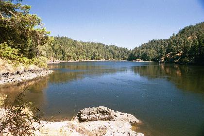
Near Sooke |
West Coast Trail
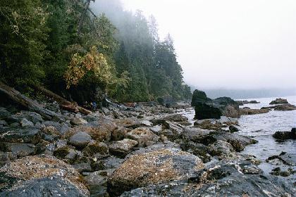
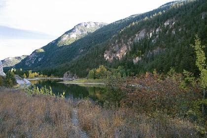
Scrambling over rocks at Owen Point |
The 75 kilometre West Coast Trail can be a hard and demanging challange. BACK TO BRITISH COLUMBIA MAPBACK TO CANADA MAP |
|
Lots of bridges (and like here - a fallen tree) will be passed. BACK TO BRITISH COLUMBIA MAPBACK TO CANADA MAP |
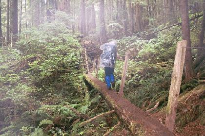
One of many bridges |
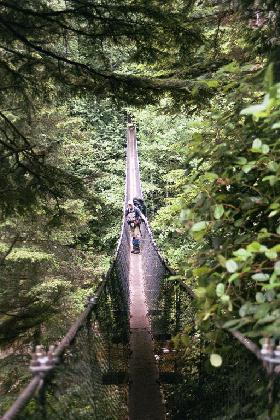
Bridge over Logan Creek |
Logan Creek suspension bridge is just one of many.... BACK TO BRITISH COLUMBIA MAPBACK TO CANADA MAP |
|
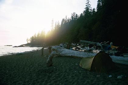
Due to heavy rain the track was muddy and tree roots made a fall easy. BACK TO BRITISH COLUMBIA MAPBACK TO CANADA MAP |
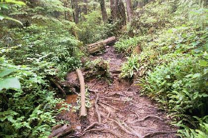
Mud and tree roots |
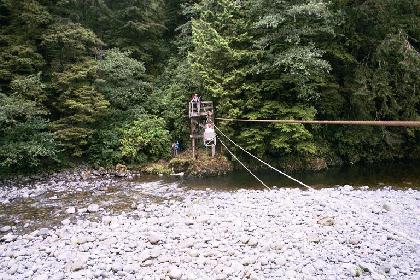
The cable car at Cullite Creek |
Several cable cars have to be pulled over creeks and rivers. BACK TO BRITISH COLUMBIA MAPBACK TO CANADA MAP |
|
Arriving at Tsusiat Falls, in sunshine, after a long day of hiking is great. BACK TO BRITISH COLUMBIA MAPBACK TO CANADA MAP |
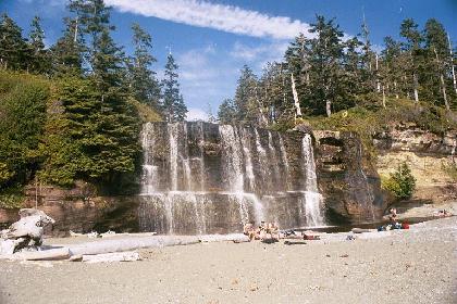
Tsusiat Falls |
Camp at Tsusiat Falls |
After a cold swim in the ocean the sunset is even more beautiful. BACK TO BRITISH COLUMBIA MAPBACK TO CANADA MAP |
Della Falls
|
At 440m tall, Della Falls is the highest waterfall in Canada. To reach the fall deep inside Strathcona Provincial Park a boat trip across Great Central Lake (35 km) is needed to get to the trailhead. From the trailhead is there another 16 km to the fall. The trail from Great Central Lake passes many creeks and small falls (here Drinkwater Creek). BACK TO BRITISH COLUMBIA MAPBACK TO CANADA MAP |
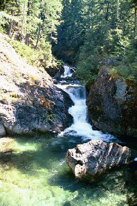
Drinkwater Creek |
Della Falls seen from the trail to Love Lake |
Della Falls can best be seen from a sidetrip to Love Lake across the valley. BACK TO BRITISH COLUMBIA MAPBACK TO CANADA MAP |
Okanagan Valley
|
Lake Okanagan is said to contain a monster called Ogopogo, a monster similar to that of Lock Ness. The Lake itself also remind one about Lock Ness. BACK TO BRITISH COLUMBIA MAPBACK TO CANADA MAP |
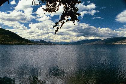
Okanagan Lake |
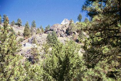
The mountains around Osoyoos |
Osoyoos is known for their production of fruit and vegetables. Osoyoos is flanked by beautiful mountains where people have build houses high on the slops. BACK TO BRITISH COLUMBIA MAPBACK TO CANADA MAP |
|
A detour from Vernon to Revelstoke (via gravel roads) takes you pass Mabel Lake. BACK TO BRITISH COLUMBIA MAPBACK TO CANADA MAP |
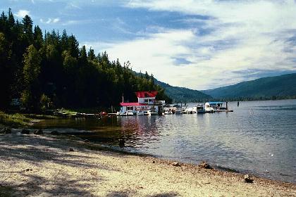
Mabel Lake |
Kootenay National Park |
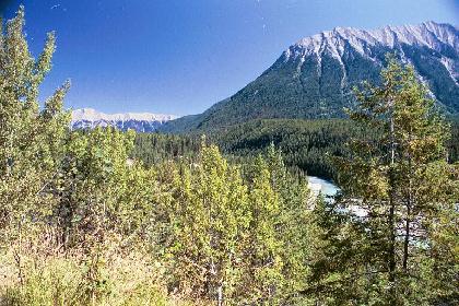
From Okanagan Valley to The Rocky Mountains the beautiful Kootenay National Park can be passed. BACK TO BRITISH COLUMBIA MAPBACK TO CANADA MAP |
|
The first breathtaking sight of the Rocky Mountains following highway 93 from Radium Hot Springs. BACK TO BRITISH COLUMBIA MAPBACK TO CANADA MAP |
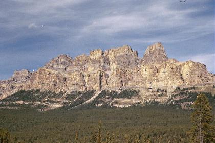
First sight of Rocky Mountains |
The Rocky Mountains
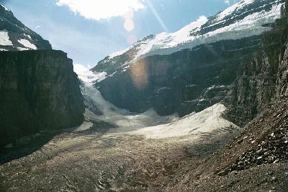
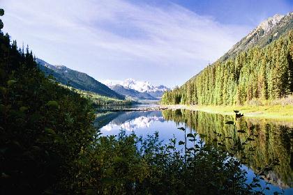
Victoria Glacier |
Follow Lake Louise via Plain of Six Glaciers to Victoria Glacier. BACK TO BRITISH COLUMBIA MAPBACK TO CANADA MAP |
|
Lake Louise is probably the most famous Lake in the area but Moraine Lake is very nice, too. BACK TO BRITISH COLUMBIA MAPBACK TO CANADA MAP |
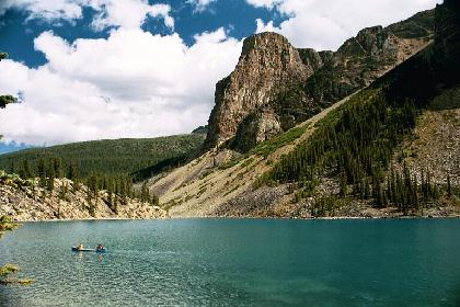
Moraine Lake |
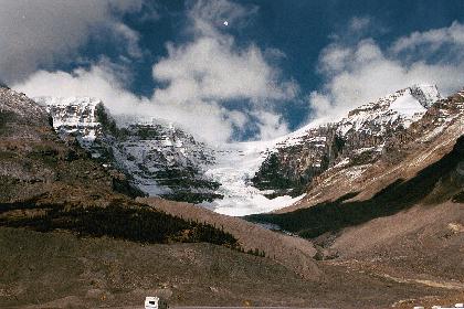
Mountains covered in newly fallen snow |
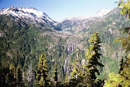
Icefields Parkway between Banff and Jaspers is worth a trip. Along the Parkway is a lots of glaciers, beautiful mountains, lakes and waterfalls. BACK TO BRITISH COLUMBIA MAPBACK TO CANADA MAP |
|
Icefields Parkway between Banff and Jaspers is worth a trip. Along the Parkway is a lots of glaciers, beautiful mountain, lakes and waterfalls. BACK TO BRITISH COLUMBIA MAPBACK TO CANADA MAP |
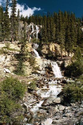
Waterfall along Icefields Parkway |
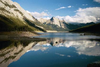
Medicine Lake |
Sunset over Medicine Lake near one of the world largest glacier-fed lakes Maligne Lake. BACK TO BRITISH COLUMBIA MAPBACK TO CANADA MAP |
|
Next to Miette Hot Springs is a beautiful dayhike to the top of the 2050m Sulpher Skyline. After a hard day of hiking it is great to relax in the hot spring. BACK TO BRITISH COLUMBIA MAPBACK TO CANADA MAP |
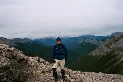
On top of the 2050m Sulpher Skyline |
Yellowhead HW (Prince George to Prince Rupert)
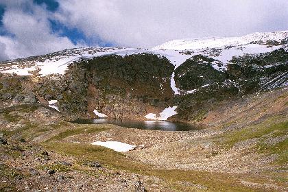
Crater Lake |
Crater Lake Trail is a short day hike in the mountains around Smithers. BACK TO BRITISH COLUMBIA MAPBACK TO CANADA MAP |
|
The road to Prince Rupert is covered by mountains and lakes. BACK TO BRITISH COLUMBIA MAPBACK TO CANADA MAP |
Morning mist over a lake outside Prince Rupert |
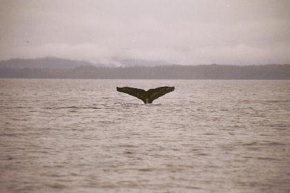
Gray Whale in Chatham Sound |
Lots of Gray Whales is to be seen in Chatham Sound just outside the town of Prince Rupert. BACK TO BRITISH COLUMBIA MAPBACK TO CANADA MAP |
|
From Terrace a detour via the dirt road to Nisga'a Memorial Lava Bed Provencial Park is worth the effort. BACK TO BRITISH COLUMBIA MAPBACK TO CANADA MAP |
On the dirt road to Nisga'a Provincial Park |
Waterfall at Nass River |
Massive volcanic formations can be found around Nisga'a and also some beautiful waterfalls. BACK TO BRITISH COLUMBIA MAPBACK TO CANADA MAP |
Cassiar HW (Terrace to Upper Liard)
|
Stewart and Hyder on the other side of the border to Alaska is a nice and relaxing community. Wild Grizzly Bears can be watched from safe distance along Fish Creek just outside Hyder. BACK TO BRITISH COLUMBIA MAPBACK TO CANADA MAP |
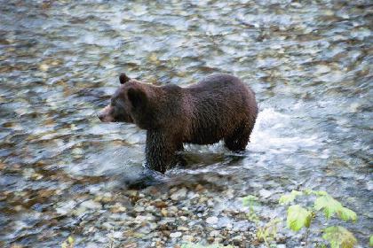
A fishing Grizzly Bear in Hyder |
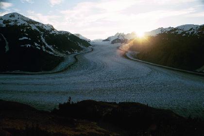
Sunset over Salmon Glacier |
40 km further north from Hyder the bumpy dirt road continue up to the top of the spectacular Slamon Glacier. BACK TO BRITISH COLUMBIA MAPBACK TO CANADA MAP |
|
It is a nice detour (120 km on gravel) from Dease Lake to the tiny settlement Telegraph Creek following the Stikine Valley. BACK TO BRITISH COLUMBIA MAPBACK TO CANADA MAP |
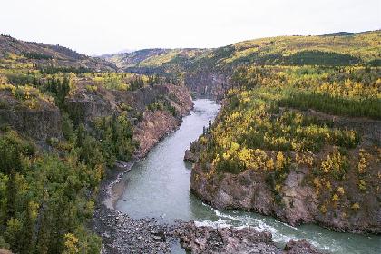
Stikine Valley near Telepraph Creek |
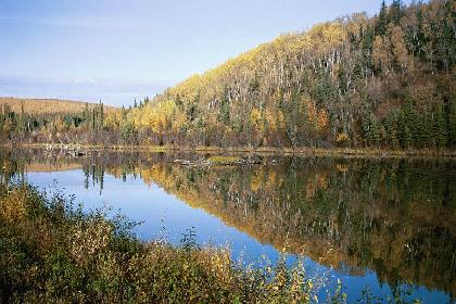
Yukon territory
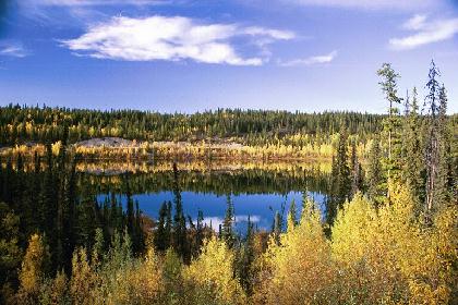
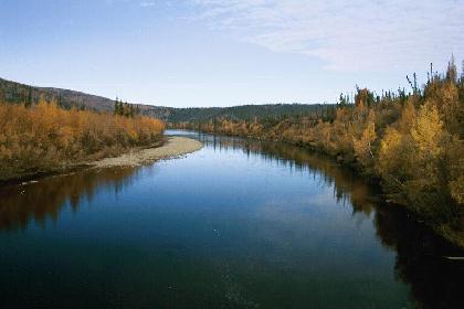
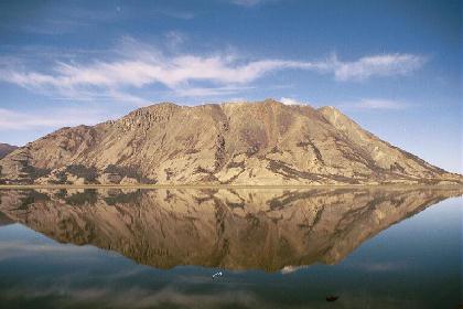
Upper Liard near Watson Lake |
This beautiful lake is to be found approximately halfway between Upper Liard and Watson Lake. BACK TO CANADA MAP |
|
Following the Klondike Highway lead to the old goldmine area around Dawson City BACK TO CANADA MAP |
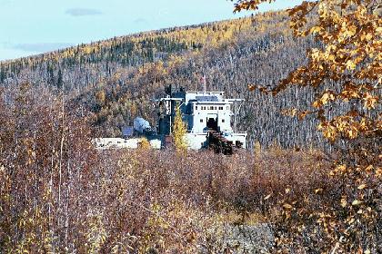
Gold dredge no. 4 outside Dawson City |
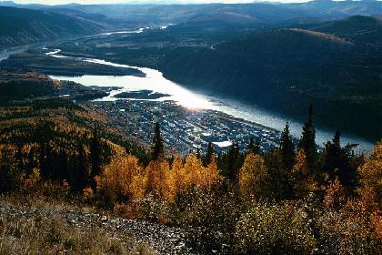
Dawson City at Klondike River bank |
Dawson City, the last "real" town in the Northern Yukon. BACK TO CANADA MAP |
South Alaska
|
From Dawson City the Top of the World Highway connect Yukon with Alaska at Poker Creek, the must northern American border station. BACK TO CANADA MAP |
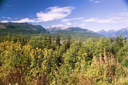
South Folk River |
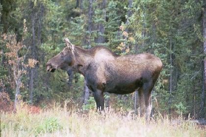
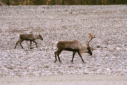
Elg along the highway |
Lots of animals could be seen along the highway, Elk, Moose, Bears and Coyotes. BACK TO CANADA MAP |
|
It is a beautiful detour fra South Junction to Valdez over Thompson and Marshall Pass. BACK TO CANADA MAP |
Horsetail Falls near Valdez |
Arctic Circle/north Alaska
Tok to Fairbanks |
The highway from Tok to Fairbanks is beautiful with lots of nice lakes and rivers. BACK TO CANADA MAP |
|
Fairbanks is the largest town in north of Alsaka. On clear days America's tallest mountain Mt. McKinley (20.320 ft.) can be seen clearly. BACK TO CANADA MAP |
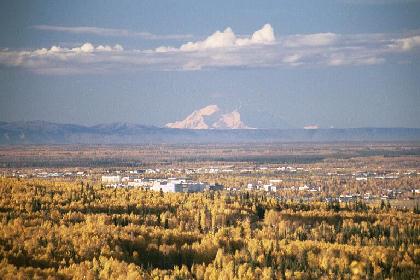
Fairbanks with Mt. McKinley in the background |
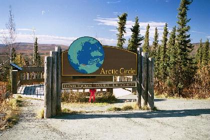
Arctic Circle |
The Arctic Circle mark can be found following Dalton Highway (a dirt road) approximately 350 km north of Fairbanks. BACK TO CANADA MAP |
Alaska Highway
|
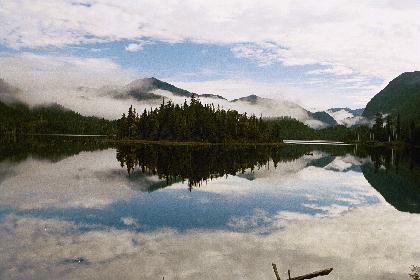
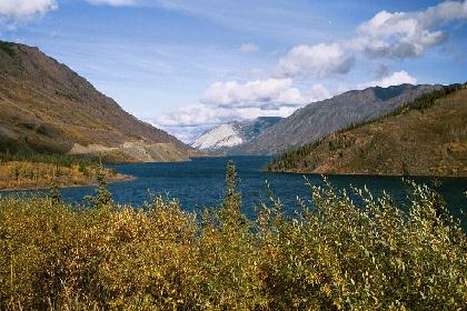
Early in the morning mountains mirrored in beautiful lakes. BACK TO BRITISH COLUMBIA MAPBACK TO CANADA MAP |
Sunrise over lake between Beaver Creek and Whitehorse |
Detour to Skagway in Alaska |
From Carcross there is only a short distance to Skagway. BACK TO BRITISH COLUMBIA MAPBACK TO CANADA MAP |
|
Lots of deers could be seen walking on and beside the highway all the way from Liard River Hotspring to Fort St. John. BACK TO BRITISH COLUMBIA MAPBACK TO CANADA MAP |
Many wild animals walked along the Alaska HW |
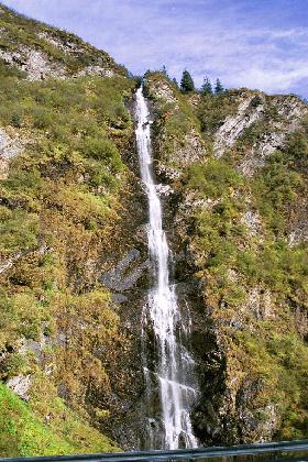
Dawson Creek
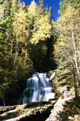
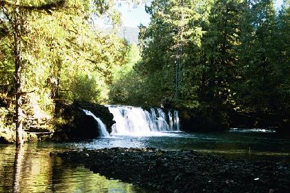
This beautiful waterfall could be seen near Dawson Creek |
Dawson Creek is the starting/finish point on the 2288 km Alaska Highway to Delta Junction in Alaska. BACK TO BRITISH COLUMBIA MAPBACK TO CANADA MAP |
Gold Rush Trail
|
The mountains around Lillooet is spectacular. BACK TO BRITISH COLUMBIA MAPBACK TO CANADA MAP |
Nice scenery near the small town Lillooet |
Lake near Whistler |
A beautiful lake near Whistler with snowy mountains in the background. BACK TO BRITISH COLUMBIA MAPBACK TO CANADA MAP |
This Homepage is created by Kim Risager 23th of June 2002.